


주요 기능
-
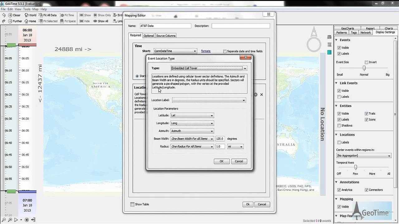
데이터 수집
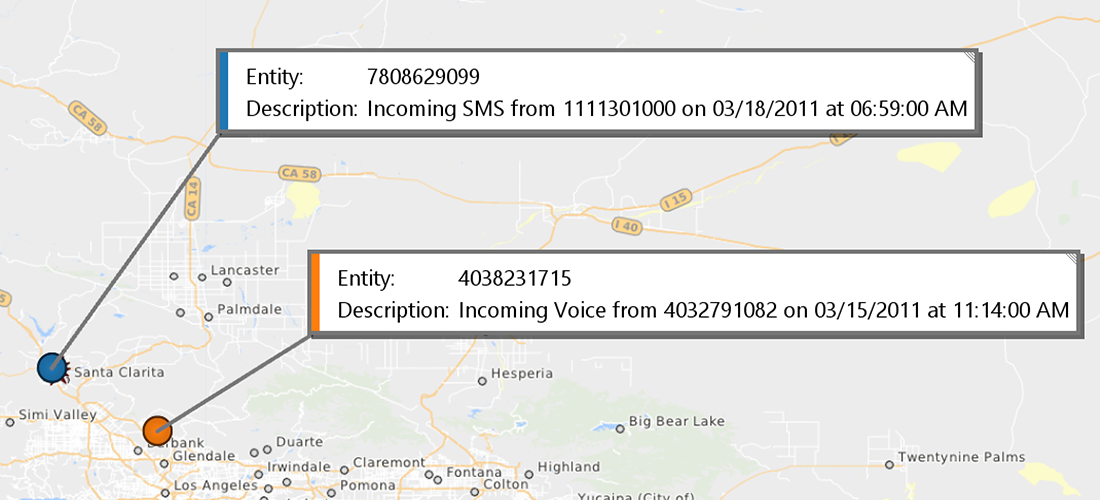
통화 세부 데이터 정리 및 형식화
보기 어려운 원본 데이터를 이해하기 쉽도록 컨텐츠로 변환하여 사용할 수 있습니다
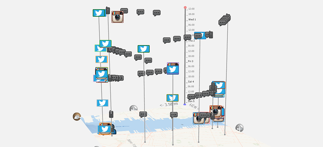
폭 넓은 데이터 수집 범위
CDR(Cell Detail record), GPS, Cellebrite 추출 데이터, Twitter, Facebook, Snapchat, Instagram 등
실시간 이메일 맵핑
이메일 계정을 연동하여 실시간으로 위치 알림을 확인 할 수 있습니다.
-
분석
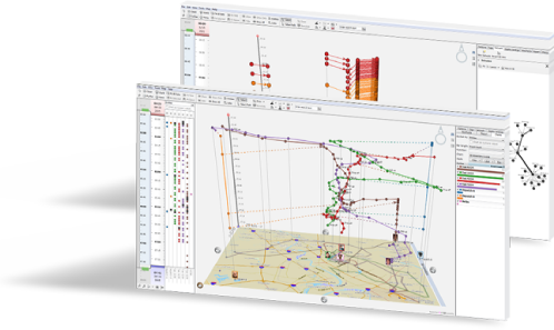
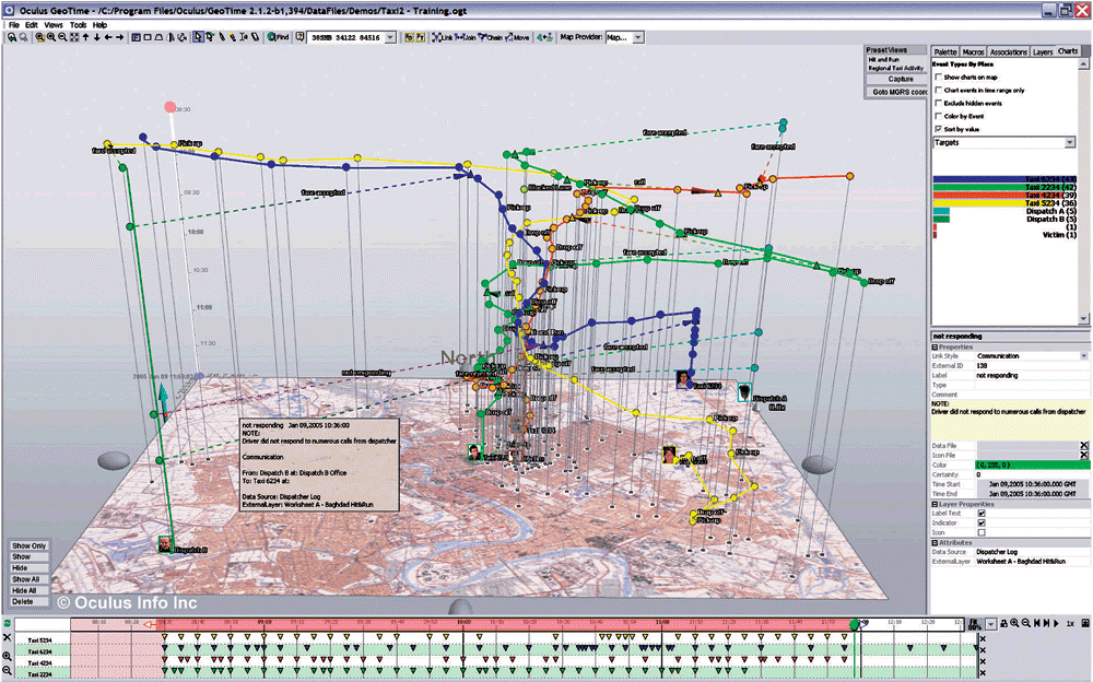
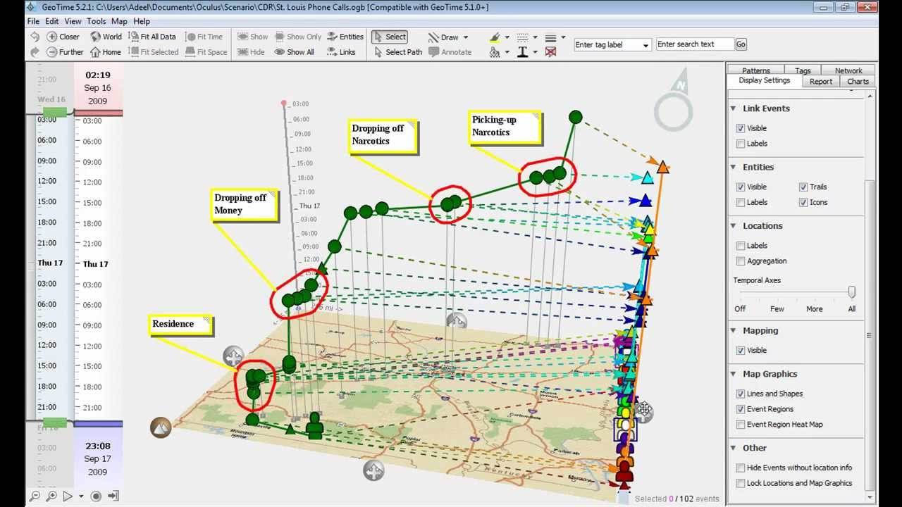
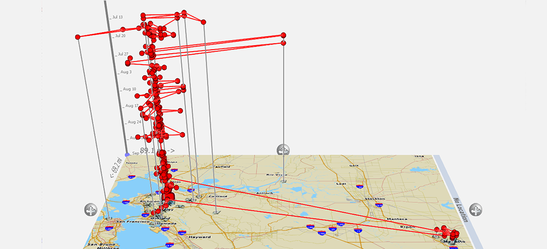
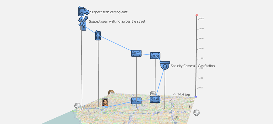
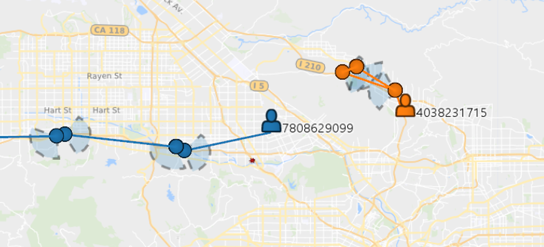
3D 화면을 통한 심도 있는 분석
맵핑 기술과 3D 타임라인 기술은 놓치고 갈 수 있는 사건의 숨은 면을 쉽게 확인할 수 있습니다.
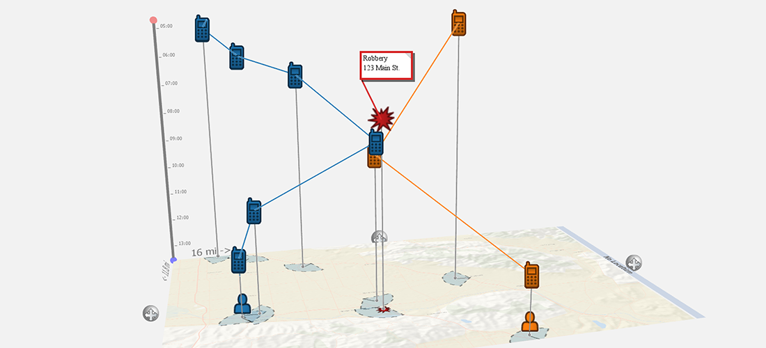
차트 분석
엔티티 간의 관계를 쉽게 식별할 수 있습니다.
자동화 분석 기능
범죄 현장에서 대상 배치를 위해 위치정보, 시간 등 자동으로 분석 가능합니다.
-
보고
한번의 클릭으로 보고서 게시
PowerPoint, 애니메이션 비디오 및 이미지로 시각 자료를 출력합니다. 충격적인 법정 프리젠 테이션
애니메이션 동영상
조사자, 분석가 및 법정 발표자와 애니메이션 동영상을 공유하여 시간 경과에 따른 목표 이동을 제시합니다.
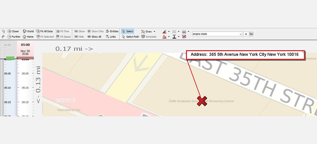
주석 마킹
매핑 노트 및 주석이 있는 지도를 마크 업하여 이야기를 전달합니다.
-
Spot Outliers
See movement patterns instantly and quickly spot outliers in activity.
-
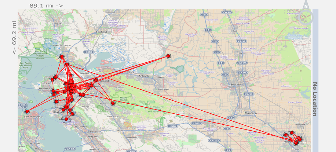
Mapping
Map all of your data quickly to see the geographic scope.
-
Time Location
Visualize time and location together to communicate meaningful interactions.
-
Watch movements
Watch movement develop over time.
-
Layer Data
Layer data sets to see a comprehensive picture of activity.
-
Geocoding
Search locations of interest directly within GeoTime and layer onto your data analysis for quick insights.
-
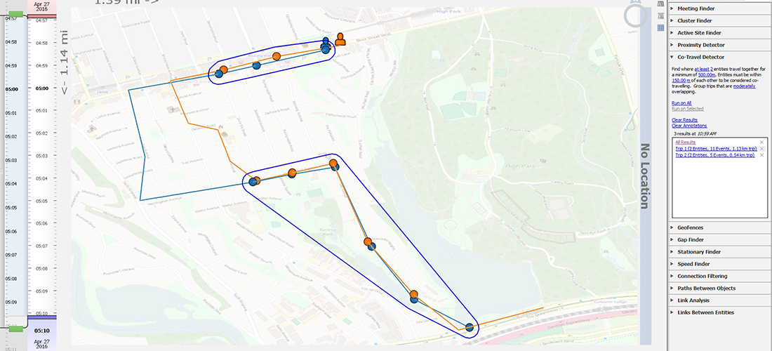
Co-Travel Detector
Calculate possible co-travel between entities inside your big data.
-
Color Matching
Callouts and entity colors match to distinguish multiple data sets.
-
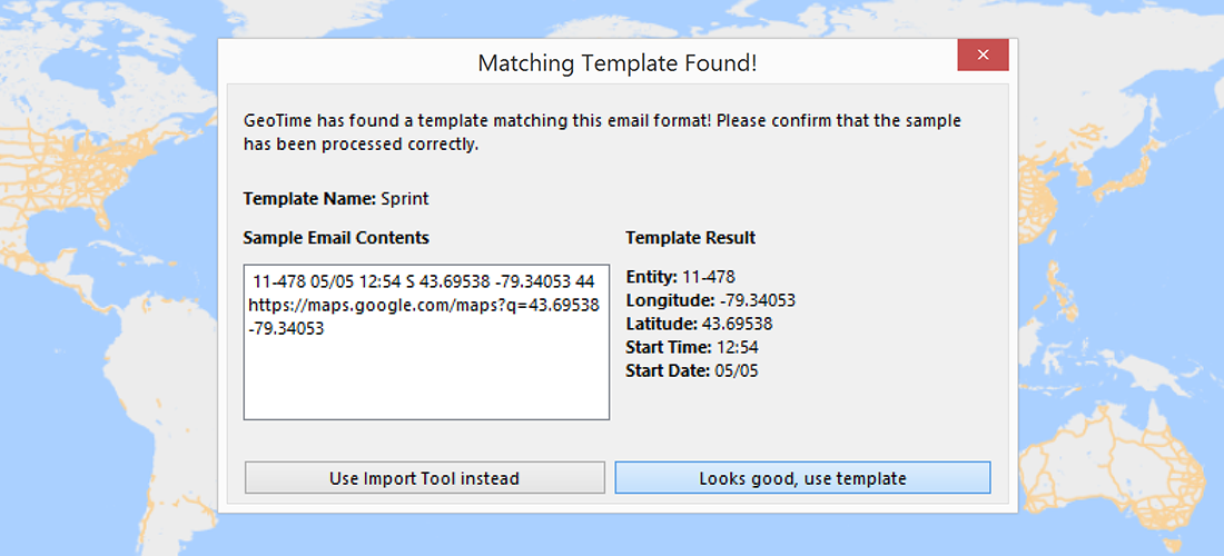
Live Ping Emails
Simple connections and auto-mapping of live location alerts.
-
Follow Mode
Record a video following your target around the map for a visually compelling replay of the target’s activities.
-
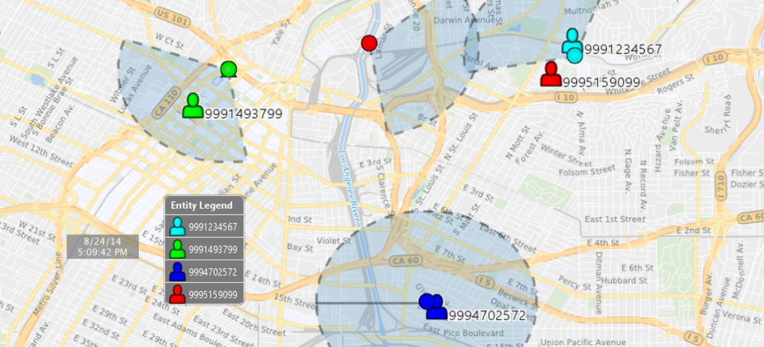
Map Details
Display an entity legend or the activity time on the map during animation for easy visual understanding.